
Cartopy is a Python package designed for geospatial data processing in order to produce maps and other geospatial data analyses.
Starting in 2016, Basemap came under new management. The Cartopy project will replace Basemap, but it hasn’t yet implemented all of Basemap’s features. All new software development should try to use Cartopy whenever possible, and existing software should start the process of switching over to use Cartopy.
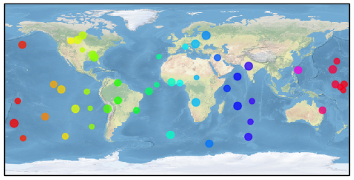
import cartopy.crs as ccrs
import matplotlib.pyplot as plt
import numpy as np

ax = plt.axes(projection=ccrs.PlateCarree())
ax.stock_img()

n=50
x = 360.0 * np.random.rand(n) - 180.0
y = 120.0 * np.random.rand(n) -  60.0
r =  50.0 * np.random.rand(n) +  20.0

plt.scatter(x, y, c=x, s=r, cmap='hsv', alpha=0.75)
plt.show()